Support for Spatial Objects Within the 'mlr3' Ecosystem.
mlr3spatial 
Package website: release | dev
mlr3spatial is the package for spatial objects within the mlr3 ecosystem. The package directly loads data from sf objects to train any mlr3 learner. The learner can predict on various raster formats (terra, raster and stars) and writes the prediction raster to disk. mlr3spatial reads large raster objects in chunks to avoid memory issues and predicts the chunks in parallel. Check out mlr3spatiotempcv for spatiotemporal resampling within mlr3.
Resources
There are sections about spatial data in the mlr3book.
- Learn how to predict a spatial raster image.
- Estimate the performance of a model with spatial cross-validation.
The gallery features articles about spatial data in the mlr3 ecosystem.
- Learn the basics with a land cover classification of the city of Leipzig.
Installation
Install the last release from CRAN:
install.packages("mlr3spatial")
Install the development version from GitHub:
remotes::install_github("mlr-org/mlr3spatial")
Example
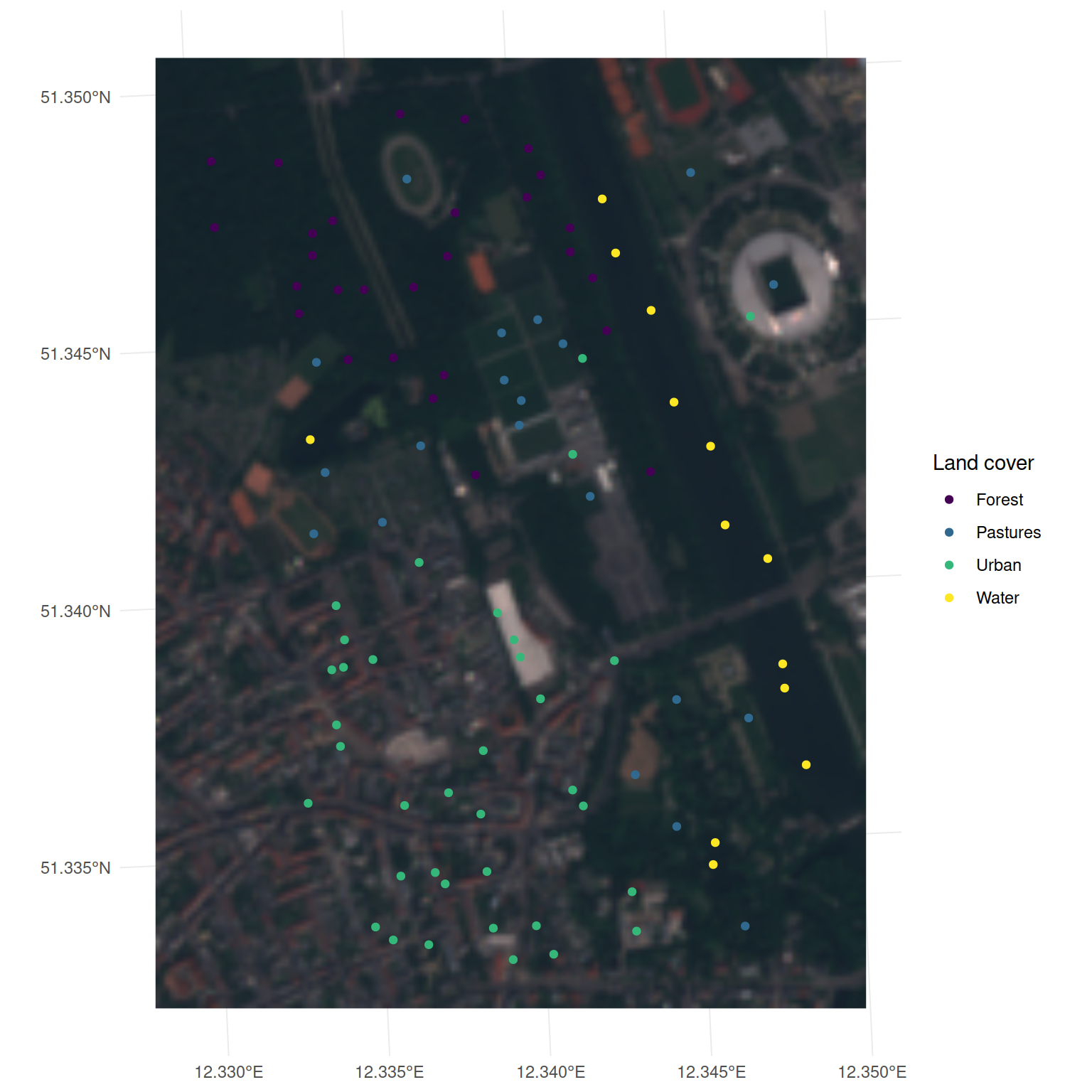
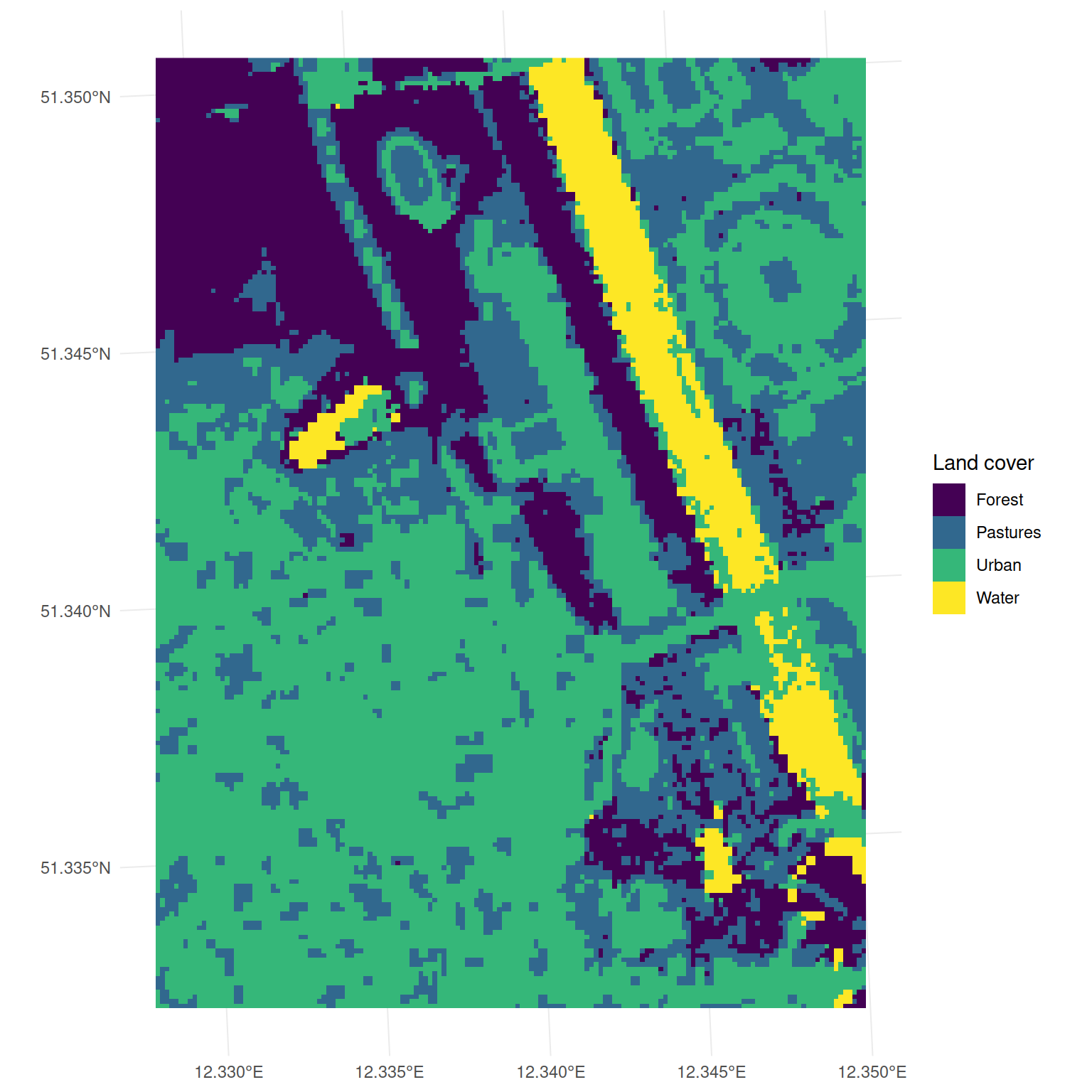
Our goal is to map the land cover of the city of Leipzig. The mlr3spatial package contains a Sentinel-2 scene of the city of Leipzig and a point vector with training sites. The Sentinel-2 scene is a 10m resolution multispectral image with 7 bands and the NDVI. The points represent samples of the four land cover classes: Forest, Pastures, Urban and Water. We load the raster with the terra package and the vector with the sf package in the R Session.
library(mlr3verse)
library(mlr3spatial)
library(terra, exclude = "resample")
library(sf)

leipzig = read_sf(system.file("extdata", "leipzig_points.gpkg", package = "mlr3spatial"), stringsAsFactors = TRUE)

leipzig_raster = rast(system.file("extdata", "leipzig_raster.tif", package = "mlr3spatial"))
The function as_task_classif_st() converts the sf::sf object to a spatial classification task.
task = as_task_classif_st(leipzig, target = "land_cover")
task
##
## ── <TaskClassifST> (97x9) ──────────────────────────────────────────────────────────────────────────
## • Target: land_cover
## • Properties: multiclass
## • Features (8):
##   • dbl (8): b02, b03, b04, b06, b07, b08, b11, ndvi
## * Coordinates:
##            X       Y
##  1: 732480.1 5693957
##  2: 732217.4 5692769
##  3: 732737.2 5692469
##  4: 733169.3 5692777
##  5: 732202.2 5692644
## ---
## 93: 733018.7 5692342
## 94: 732551.4 5692887
## 95: 732520.4 5692589
## 96: 732542.2 5692204
## 97: 732437.8 5692300
The points are located in the district of Lindenau and Zentrum-West.

Now we train a classification tree on the leipzig task.
learner = lrn("classif.rpart")
learner$train(task)
As a last step, we predict the land cover class for the whole area of interest. For this, we pass the Sentinel-2 scene and the trained learner to the predict_spatial() function.
land_cover = predict_spatial(leipzig_raster, learner)
## Warning in warn_deprecated("DataBackend$data_formats"): DataBackend$data_formats is deprecated and
## will be removed in the future.

FAQ
Will mlr3spatial support spatial learners?
Eventually. It is not yet clear whether these would live in mlr3extralearners or in mlr3spatial. So far there are none yet.
Why are there two packages, mlr3spatial and mlr3spatiotempcv?
mlr3spatiotempcv is solely devoted to resampling techniques. There are quite a few and keeping packages small is one of the development philosophies of the mlr3 framework. Also back in the days when mlr3spatiotempcv was developed, it was not yet clear how we want to structure additional spatial components such as prediction support for spatial classes and so on.
