Description
Find the Pole of Inaccessibility (Visual Center) of a Polygon.
Description
A wrapper around the C++ library 'polylabel' from 'Mapbox', providing an efficient routine for finding the approximate pole of inaccessibility of a polygon, which usually serves as an excellent candidate for labeling of a polygon.
README.md
polylabelr
![]()
![]()
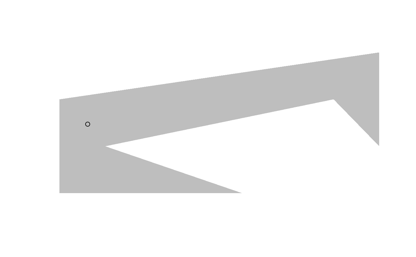
polylabelr is an R wrapper for the polylabel package from Mapbox. It currently contains a single function, poi() that finds the pole of inaccessibility of a polygon, which usually makes for a good place to put a label on a polygon—hence the name.
Usage
# a concave polygon
x <- c(0, 4, 1, 6, 7, 7, 0, 0)
y <- c(0, 0, 1, 2, 1, 3, 2, 0)

# locate the pole of inaccessibility
p <- polylabelr::poi(x, y, precision = 0.01)

plot.new()
plot.window(range(x, na.rm = TRUE), range(y, na.rm = TRUE), asp = 1)
polypath(x, y, col = "grey", border = FALSE)
points(p)
Installation
CRAN version
install.packages("polylabelr")
Development version
remotes::install_github("jolars/polylabelr")
Modifications
The source code from geometry.hpp has been modified slightly by removing the use of some GCC diagnostic pragmas that caused warnings in R CMD check.
Versioning
polylabelr uses semantic versioning.