Convert Digital Images into 'SpatRaster' Objects.
rasterpic 

![]()
![]()

rasterpic is a tiny package with a single goal: to transform an image into a terraSpatRaster object (see ?terra::SpatRaster).
Installation
Install rasterpic from CRAN:
install.packages("rasterpic")
Check the documentation for the development version at https://dieghernan.github.io/rasterpic/dev/.
You can install the development version of rasterpic with:
# install.packages("pak")
pak::pak("dieghernan/rasterpic")
Alternatively, you can install rasterpic using the r-universe:
# Install rasterpic in R.
install.packages(
  "rasterpic",
  repos = c(
    "https://dieghernan.r-universe.dev",
    "https://cloud.r-project.org"
  )
)
Example
You can create custom maps with several spatial input classes:
- sf classes:
sf,sfc,sfgorbbox. - terra classes:
SpatRaster,SpatVectorandSpatExtent. - stars classes:
stars. - A numeric coordinate vector of the form
c(xmin, ymin, xmax, ymax).
The main function, rasterpic_img(), is an S3 generic. The methods for extent-like inputs use the object extent, and vector methods can also mask the image to the object shape.
An example using an sf object:
library(rasterpic)
library(sf)
library(terra)
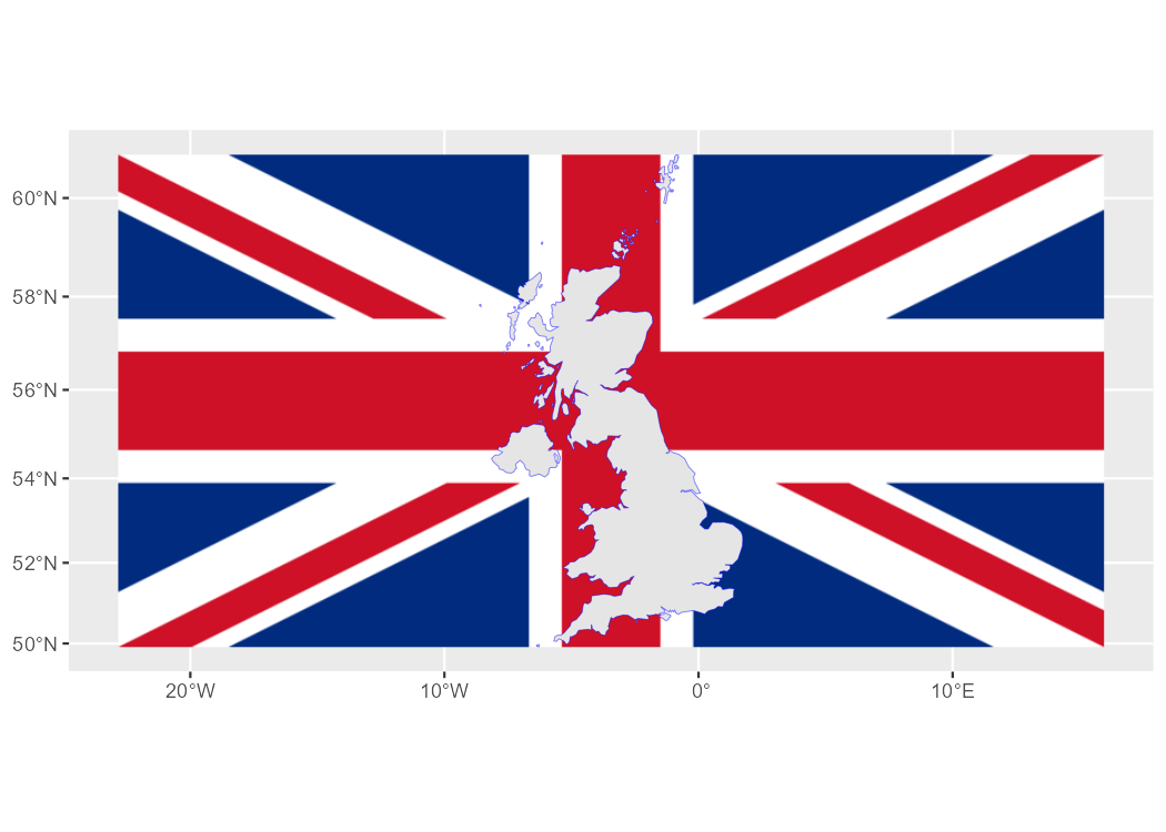
# Use the flag of the United Kingdom.
img <- system.file("img/UK_flag.png", package = "rasterpic")
uk <- read_sf(system.file("gpkg/UK.gpkg", package = "rasterpic"))
class(uk)
#> [1] "sf" "tbl_df" "tbl" "data.frame"
# Rasterize the image.
uk_flag <- rasterpic_img(uk, img)
uk_flag
#> class : SpatRaster
#> size : 400, 800, 3 (nrow, ncol, nlyr)
#> resolution : 5398.319, 5398.319 (x, y)
#> extent : -2542183, 1776472, 6430573, 8589900 (xmin, xmax, ymin, ymax)
#> coord. ref. : WGS 84 / Pseudo-Mercator (EPSG:3857)
#> source(s) : memory
#> colors rgb : 1, 2, 3
#> names : r, g, b
#> min values : 0, 14, 35
#> max values : 255, 255, 255
# Plot with ggplot2 and tidyterra.
library(tidyterra)
library(ggplot2)
autoplot(uk_flag) +
geom_sf(data = uk, color = alpha("blue", 0.5))
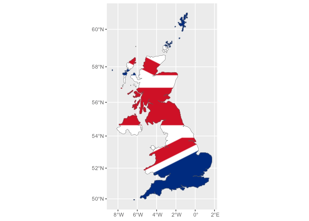
We can also adjust other parameters and modify the alignment of the image with respect to the object:
# Align, crop and mask.
uk_flag2 <- rasterpic_img(uk, img, halign = 0.2, crop = TRUE, mask = TRUE)

autoplot(uk_flag2) +
  geom_sf(data = uk, fill = NA)
Supported image formats
rasterpic can parse the following image formats:
pngfiles.jpeg/jpgfiles.tiff/tiffiles.
Citation
Hernangómez D (2026). rasterpic: Convert Digital Images to SpatRaster Objects. doi:10.32614/CRAN.package.rasterpic. https://dieghernan.github.io/rasterpic/.
A BibTeX entry for LaTeX users is:
@Manual{R-rasterpic,
  title = {{rasterpic}: Convert Digital Images to {SpatRaster} Objects},
  doi = {10.32614/CRAN.package.rasterpic},
  author = {Diego Hernangómez},
  year = {2026},
  version = {0.5.0},
  url = {https://dieghernan.github.io/rasterpic/},
  abstract = {Create SpatRaster objects, as defined by the terra package, from digital images using a spatial object as a geographic reference. Supported inputs include objects from the sf, terra and stars packages. The main function is an S3 generic, so other packages can provide methods for additional spatial classes.},
}